Bhola Cyclone of 1970

The 1970 Bhola cyclone (also known as the Great Cyclone of 1970) was a devastating tropical cyclone that struck East Pakistan (present-day Bangladesh) and India’s West Bengal on November 12, 1970. It remains the deadliest tropical cyclone ever recorded and one of the world’s deadliest humanitarian disasters. At least 300,000 people died in the storm, possibly as many as 500,000, primarily as a result of the storm surge that flooded much of the low-lying islands of the Ganges Delta. Bhola was the sixth and strongest cyclonic storm of the 1970 North Indian Ocean cyclone season.

Yajnaseni Chakraborty writes in an online article, that the cyclone also formed a new nation: Bangladesh. Since the 1940’s East-Bengal had been a part of Pakistan, officially called East-Pakistan, and was governed by the central Pakistani military government:
“A few days after the disaster, with East Pakistanis seething in anger against the West Pakistan government, political leader Maulana Abdul Hamid Khan Bhashani held a rally at Dhaka’s old Paltan Maidan, famously declaring, “Ora keu aseni (none of them turned up),” and went on to say, “From today, we are independent East Bengal, no longer East Pakistan”. The next day, says Haider, ‘Ora keu aseni’ was printed as a banner headline in the newspaper ‘Pakistani Khabar’, controlled by the Pakistan government’s Press Trust.”

The following Bengal War in 1971 took another 3 million Bengali lives, according to the Bangladesh government. In August 1971 the nation was finally declared independent. Today Bangladesh is regarded as one of those countries with a highly effective disaster protection program.

The Bride and the Sink Hole

The city of Alexandria once had an extensive network of water cisterns below ground that distributed drinking water from a channel connecting the river Nile south-east of the city with the city’s harbor in the west. This was vital for the survival of the population as the Nile flood brought sweet water to the city only once in the summer months. The water needed to be stored for the remaining year and the deep cisterns served that purpose. As the „city of layers“, as it is often referred to, grew and layers upon layers of streets and buildings were added, the cisterns underground would collapse from time to time, creating sink holes and cracks in the streets. In some areas, sea water dissipates into the ground, further enhancing the erosion of the structure.

The artist Islam Shabana told me the following story: In 1973 a young, newly wed woman fell into a sink hole that suddenly opened up under her. When people came to her rescue she disappeared completely into the abyss. Rescue teams climbed after her but never found the body.

The disappearance of a young woman in broad daylight and right before the eyes of the people is of course the stuff for an enduring urban legend. One popular story speculates that she was abducted by a love-struck Jinn who was enraged by her marriage to another man.

The woman is simply referred to by Alexandrians as „The Bride“. Alexandria itself is called „The Bride of the Mediterranean“ and one of Alexandria’s emblematic figures is the mermaid, which in Arab means „Bride of the Sea“. And what makes this story for Alexandrians even more meaningful is, that in the same street the Bride disappeared another body disappeared too: the body of the city’s founder Alexander the Great. As was confirmed to me by Islam Shabana, Al Naby Danyal (Prophet Daniel Street) is the most probable location of the shrine that held the emperor’s body, referred to as Soma, meaning simply „The Body“. The building and Alexander’s remains are lost and it is unclear what happened to them. Historian Islam Issa writes, that most probably it was situated on the corner of Al Naby Danyal and Fuad Street and might still be there, only underground.

Today even more than in the 1970s, sink holes are appearing everywhere in the city, especially in the winter months. The ground below Alexandria is hollowed like a Swiss cheese, as historian Kathrin Machinek explained to me. The cisterns have not been in use for decades and there are so many, that it is impossible to say, where and when the next one will collapse. The sea level rise in the Mediterranean and land subsidence due to the incessant building activity above ground makes matters worse.

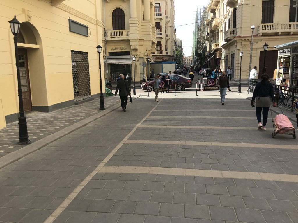
Prophet Daniel Street, freshly paved, on the corner of Fuad Street in April 2024.

Thanks to Islam Shabana for the lead!

Storm surge events on the North Sea

12/26/838
First documented storm surge in the North Sea; Approximately 2,500 deaths in what is now the Netherlands.

2/17/1164
First Julian flood: 20,000 dead; First collapse of the Jade Bay, major damage in the Elbe area.

1/16/1219
First Marcellus flood: 36,000 dead: major floods also in the Elbe area; first conveyed eyewitness report.

12/28/1248
Allerkindslein flood: High loss of human life. The historic Elbe island of Gorieswerder is divided into several parts.

12/14/1287
Lucia Flood: Beginning of the formation of the Dollart, 50,000 dead.

11/23/1334
Clemens Flood: Expansion of the Jade Bay.

1/16/1362
Second Marcellus Flood, Grote Manndranke: 100,000 dead: first collapse of the Dollart, expansion of Leybucht, Hariebucht, Jade Bay and Eider Estuary, sinking of large parts of North Frisia.

10/09/1374
First Dionyslus flood: Largest extent of the Leybucht up to the city of Norden, sinking of the village of Westeel near Norden.

9/10/1377
Second Dionysiusflut: Dikes near Lütetsburg and Bargebur
torn, the waves hit the walls of the Dominican monastery in Nord.

11/21/1412
Cacilien flood: An entire village at the mouth of the Este was destroyed, and the Elbe island of Hahnöfersand was separated from the mainland.

11/1/1436
Allerhelligen flood: Flooding on the entire North Sea coast, especially in Eiderstedt and Nordstrand.

1/6/1470
Epiphany Flood: Flooding in Eiderstedt, no permanent land losses.

09/26/1509
Cosmas and Damian flood: Breakthrough of the Ems
near Emden, largest expansion of the Dollart, last expansion of the Jade Bay to the northwest.

01/16/1511
Antonius flood, ice flood: breakthrough between Jade and Weser.

10/31 and 11/1/1532
Third All Saints Flood: Several thousand dead in North Frisia, first peak value recorded in the church of Klibüll; Sinking of Osterbur and Ostbense in East Frisia.

11/01/1570
Fourth All Saints Flood: Flooding of the marshes from Flanders to Eiderstedt: large dike breaches in the Altes Land as well as in the Vier- und Marschenlanden; Sinking of the villages of Oldendorf and Westbense near Esens: 9,000 to 10,000 dead between Ems and Weser. High tide mark at the Suurhusen church at NN +4.40 m.

2/26/1625
Carnival flood: An ice flood, dike breaches and major damage in East Frisia and Oldenburg, in the Altes Land and Hamburg, many dikes breaches on Jade and Weser.

10/11/1634
Second Grote Manndranke: Strand Island sinks; What remains are the islands of Nordstrand and Pellworm; at least 8,000 dead.

2/22/1651
Petri flood: “Dane chains” broken on Juist and Langeoog, Dornumersiel was destroyed, there were dike breaches on the mainland.

11/12/1686
Martin’s Flood: Severe damage to dikes from the Netherlands to the Elbe.

12/24 to 12/25/1717
Christmas flood: 11,150 dead from Holland to the Danish coast: the largest storm surge known to date with flooding and devastation of enormous proportions.

12/31/1720 to 01/01/1721
New Year’s flood: higher than Christmas flood; Destruction of the dikes that were poorly repaired after 1717; Sinking of the villages Bettewehr II and Itzendorf

2/3 to 2/4/1825
February flood: 800 dead; There were many dike breaches along the coast and severe loss of dunes on the islands. Highest storm surge on the Elbe until 1962.

1/1 to 1/2/1855
January flood: Heavy destruction on the East Frisian Islands, storm surge mark on Norderney at NN +4.26 m.

3/13/1906
March flood: highest storm surge recorded to date on the East Frisian coast.

1/31 to 2/1/1953
Dutch flood: worst natural disaster of the 20th century in the North Sea area. In the Netherlands approx. 1,800 dead, England and Belgium more than 2,000 dead; Total damage more than €500 million: no major damage to the German coast, but an impetus to check the dikes.

2/16 to 2/17/1962
February storm surge, Second Julian flood: 340 dead, 19 of them in Lower Saxony, approx. 28,000 apartments or houses damaged and 1,300 completely destroyed; highest storm surge to date East of the Jade with 61 dike breaches in Lower Saxony; The Elbe area and its tributaries were particularly affected.

1/3/1976
January flood: highest storm surge to date on almost all pegs on the German North Sea coast: numerous dike breaches in Kehdingen and the Haseldorfer Marsch.

11/24/1981
November flood: Highest peak water level in North Frisia with NN +4.72 m at the Dagebüll gauge.

1/28/1994
January flood: Highest peak water levels on the Ems with NN +4.75 m at the Weener gauge and on the Wese with NN +5.33 m at the Vegesack gauge.

12/3/1999
Anatol: short-term increase with very high water levels in the entire North Sea region; The storm subsided before the astronomical flood occurred in Cuxhaven, otherwise the values ​​of 1976 had been exceeded in the Elbe area.

11/01/2006
Fifth All Saints Flood: Very severe storm surge with water levels exceeding the 1994 levels in the Ems area, dike collapses on the East Frisian islands of Juist, Langeoog and Wangerooge…

This list was assembled by Christian von Wissel of Bremer Zentrum für Baukultur. It was part of the exhibition “Deichstadt #1” in spring 2024.

A living thing – the Barrier Islands of North Carolina

The only constant is the creed of the Barrier Islands of North Carolina according to marine scientist Orin Pilkey. In his introduction to this PBS documentary from the 1980s, Pilkey provocatively comments the image of beach houses slowly being swallowed by the sea with the following words: “For some this is a tragic and an ugly sight. But I think it’s beautiful. Because surrendering this house to the sea represents a bright promise for our future.” He later says “I’ve really come to think of these islands as living things. They are constantly responding in sensible and even intelligent ways to the forces of nature.”

Video link

The evocative title of the documentary refers to the slow movement of these islands over millennia. But as Pilkey makes clear, islands lie these will continue to move and need to move in order to sustain. So called “hard stabilization”, the effort to stabilize shore lines by sea walls and other massive concrete structures, Pilkey calls “a recipe for disaster”.

In contrast to today’s buildings and infrastructure the early settlements on the islands were much less permanent. Some of the early settler’s houses on these islands were equipped with a trap door in the house, in order to let flood water flow through to limit the damage to the house’s structure. Many houses were even built in ways, so that they could be easily moved away from the shore. Houses but also whole villages, like Diamond city, appeared and disappeared across the islands over the course of it’s history of settlement.

This film and Pilkeys argument are actually pre-climate-discourse at least as public opinion is concerned. This makes it a fascinating document of the development of environmental thought. Basically all the worries, warnings and arguments of today’s coastal climate adaptation discourse are here – but without sea level rise! It’s simply ill guided real estate development and false landscape planning.

Alexandria III

The God Abandons Antony

by C.P. Cafavy

When suddenly, at midnight, you hear
an invisible procession going by
with exquisite music, voices,
don’t mourn your luck that’s failing now,
work gone wrong, your plans
all proving deceptive—don’t mourn them uselessly.
As one long prepared, and graced with courage,
say goodbye to her, the Alexandria that is leaving.
Above all, don’t fool yourself, don’t say
it was a dream, your ears deceived you:
don’t degrade yourself with empty hopes like these.
As one long prepared, and graced with courage,
as is right for you who proved worthy of this kind of city,
go firmly to the window
and listen with deep emotion, but not
with the whining, the pleas of a coward;
listen—your final delectation—to the voices,
to the exquisite music of that strange procession,
and say goodbye to her, to the Alexandria you are losing.

Reprinted from C. P. CAVAFY: Collected Poems Revised Edition, translated by Edmund Keeley and Philip Sherrard, edited by George Savvidis. Translation copyright © 1975, 1992 by Edmund Keeley and Philip Sherrard. Princeton University Press. For reuse of these translations, please contact Princeton University Press.

Alexandria II

This is the introduction to “Pharos and Pharillon” a book by British writer and literary critic E.M. Forster about Alexandria. The book was published in 1923. Forster was stationed in Alexandria during his service in the British military and wrote two books about the port city.

“Before there was civilization in Egypt, or the delta of the Nile had been formed, the whole country as far south as modern Cairo lay under the sea. The shores of this sea were a limestone desert. The coast line was smooth usually, but at the north-west corner a remarkable spur jutted out from the main mass. It was less than a mile wide, but thirty miles long. Its base is not far from Bahig, Alexandria is built half-way down it, its tip is the headland of Aboukir. On either side of it there was once deep salt water.

Centuries passed, and the Nile, issuing out of its crack above Cairo, kept carrying down the muds of Upper Egypt and dropping them as soon as its current slackened. In the north-west corner they were arrested by this spur and began to silt up against it. It was a shelter not only from the outer sea, but from the prevalent wind. Alluvial land appeared; the large shallow lake of Mariout was formed; and the current of the
Nile, unable to escape through the limestone barrier, rounded the headland of Aboukir and entered the outer sea by what was known in historical times as the “Canopic” mouth.

To the north of the spur and more or less parallel to it runs a second range of limestone. It is much shorter, also much lower, lying mainly below the surface of the sea in the form of reefs, but without it there would have been no harbours (and consequently no Alexandria), because it breaks the force of the waves. Starting at Agame, it continues as a series of rocks across the entrance of the modern harbour. Then it
re-emerges to form the promontory of Ras el Tin, disappears into a second series of rocks that close the entrance of the Eastern Harbour, and makes its final appearance as the promontory of Silsileh, after which it rejoins the big spur.

Such is the scene where the following actions and editations take place; that limestone ridge, with alluvial country on one side of it and harbours on the other, jutting from the desert, pointing towards the Nile; a scene unique in Egypt, nor have the Alexandrians ever been truly Egyptian. Here Africans, Greeks and Jews combined to make a city; here a thousand years later the Arabs set faintly but durably the impress of
the Orient; here after secular decay rose another city, still visible, where I worked or appeared to work during a recent war. Pharos, the vast and heroic lighthouse that dominated the first city—under Pharos I have grouped a few antique events; to modern events and to personal impressions I have given the name of Pharillon, the obscure successor of Pharos, which clung for a time to the low rock of Silsileh and then slid unobserved into the Mediterranean.”

full book here.

Alexandria

This famous poem is by the poet Constantinos Petrou Cafavy who was born and died in the ancient port city Alexandria. He lived from 1863 to 1933 and was a member of the large Greek community in Alexandria. His poems were also written in Greek.

The City

You said: “I’ll go to another country, go to another shore,
find another city better than this one.
Whatever I try to do is fated to turn out wrong
and my heart lies buried like something dead.
How long can I let my mind moulder in this place?
Wherever I turn, wherever I look,
I see the black ruins of my life, here,
where I’ve spent so many years, wasted them, destroyed them totally.”

You won’t find a new country, won’t find another shore.
This city will always pursue you.
You’ll walk the same streets, grow old
in the same neighborhoods, turn gray in these same houses.
You’ll always end up in this city. Don’t hope for things elsewhere:
there’s no ship for you, there’s no road.
Now that you’ve wasted your life here, in this small corner,
you’ve destroyed it everywhere in the world.


from C.P. Cavafy: Collected Poems. Translated by Edmund Keeley and Philip Sherrard. Translation Copyright © 1975, 1992 by Edmund Keeley and Philip Sherrard. Reproduced with permission of Princeton University Press

Political flood images

In Germany, the imagery of flood or flooding and of Noah’s Ark is frequently used in the political discourse to refer to undesired migration. Since the 1990s this dehumanizing topos was in high demand and was used by mainstream media and radical political parties alike. The following are covers of Germany’s biggest news magazine from 1991 and from 2006, fifteen years apart. The main headline is identical: “Ansturm der Armen” which translates as “storm (or onrush) of the poor”.

Political extremists picked the imagery up instantly, as illustrated by this add by a right-wing party from 1991 and another recent cover from a right-wing political magazine:

The Wave in Architecture

It’s a rather popular architectural motif, particularly of course in coastal and riverside cities. I wonder if there ever has been a historical study of the wave in architecture. Here are a few random examples from Europe:

Dessauerstraße, Hemshof Ludwigshafen, Germany. I couldn’t find out about the architect nor he date of these buildings.

Built over the course of more than a decade and finished in 2018: The Wave in Vejle, Denemark, designed by Henning Larsen.

Elbphilarmonie in Hamburg, Germany. Opened in 2016, by architectural firm Herzog & de Meuron.

Inside of Multihalle, in Mannheim, Germany, built by Frei Otto in 1975.

Flood Memorabilia

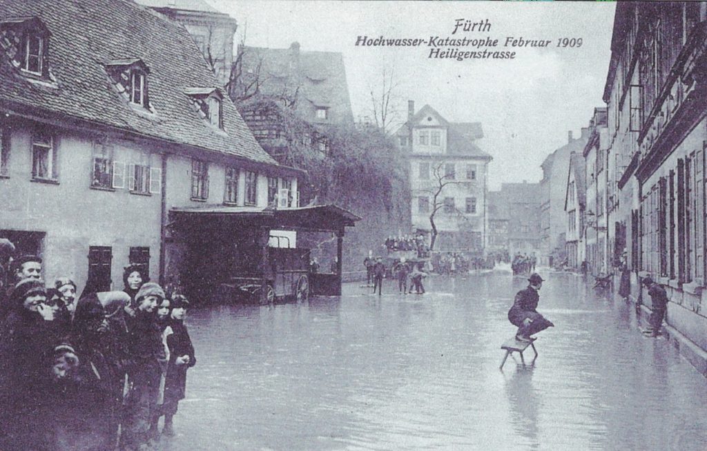
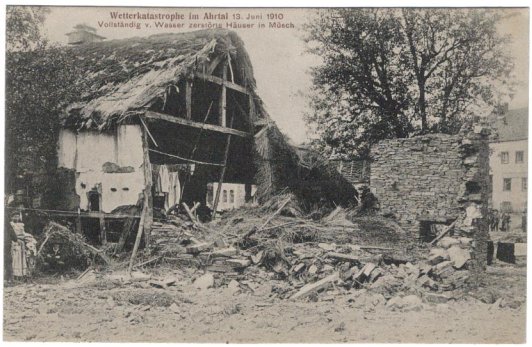
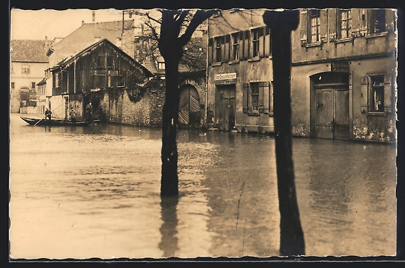
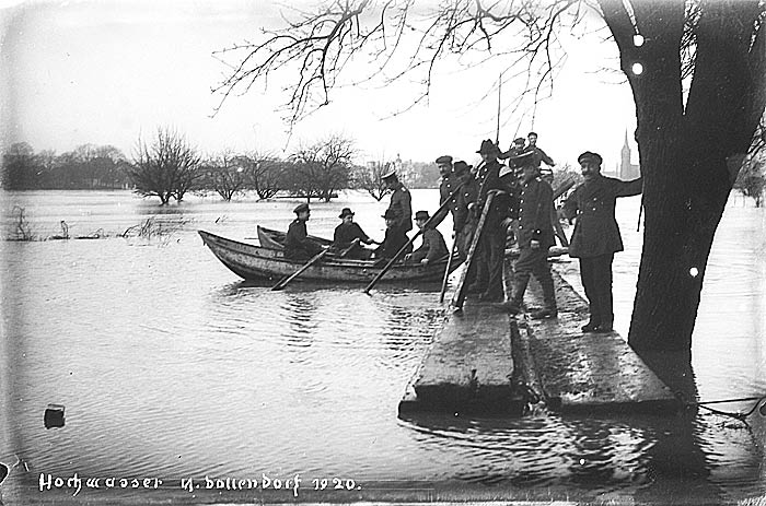
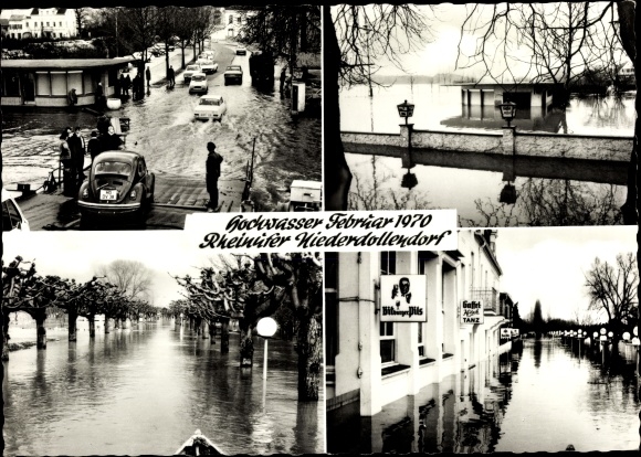
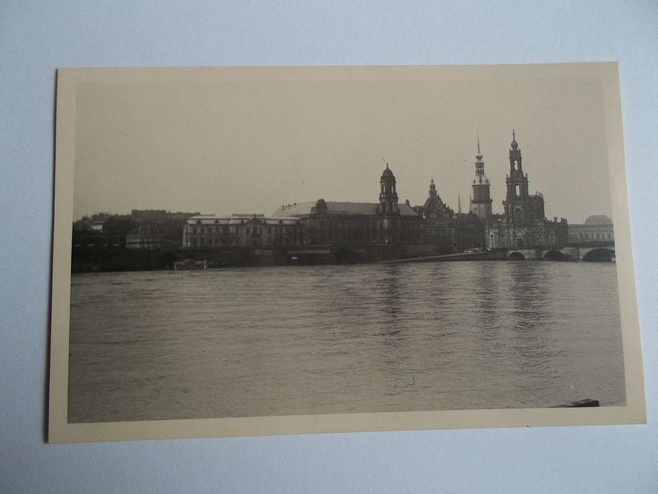
In Germany as well as in many other countries, images of extreme floods often found their way on postcards. Here is a selection of postcards. (click on the image to find the online source)

1909

1910

1914

1920

1920

1929

2002

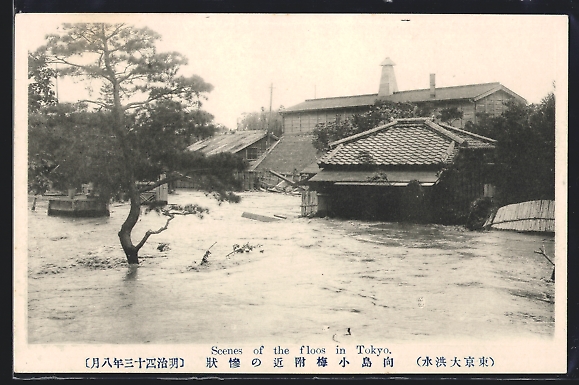
undated postcard from Tokyo, Japan

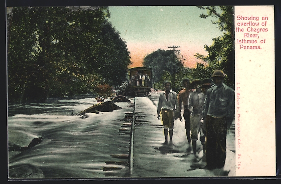
undated postcard from Panama, probably 1924