Storm surge events on the North Sea

12/26/838
First documented storm surge in the North Sea; Approximately 2,500 deaths in what is now the Netherlands.

2/17/1164
First Julian flood: 20,000 dead; First collapse of the Jade Bay, major damage in the Elbe area.

1/16/1219
First Marcellus flood: 36,000 dead: major floods also in the Elbe area; first conveyed eyewitness report.

12/28/1248
Allerkindslein flood: High loss of human life. The historic Elbe island of Gorieswerder is divided into several parts.

12/14/1287
Lucia Flood: Beginning of the formation of the Dollart, 50,000 dead.

11/23/1334
Clemens Flood: Expansion of the Jade Bay.

1/16/1362
Second Marcellus Flood, Grote Manndranke: 100,000 dead: first collapse of the Dollart, expansion of Leybucht, Hariebucht, Jade Bay and Eider Estuary, sinking of large parts of North Frisia.

10/09/1374
First Dionyslus flood: Largest extent of the Leybucht up to the city of Norden, sinking of the village of Westeel near Norden.

9/10/1377
Second Dionysiusflut: Dikes near Lütetsburg and Bargebur
torn, the waves hit the walls of the Dominican monastery in Nord.

11/21/1412
Cacilien flood: An entire village at the mouth of the Este was destroyed, and the Elbe island of Hahnöfersand was separated from the mainland.

11/1/1436
Allerhelligen flood: Flooding on the entire North Sea coast, especially in Eiderstedt and Nordstrand.

1/6/1470
Epiphany Flood: Flooding in Eiderstedt, no permanent land losses.

09/26/1509
Cosmas and Damian flood: Breakthrough of the Ems
near Emden, largest expansion of the Dollart, last expansion of the Jade Bay to the northwest.

01/16/1511
Antonius flood, ice flood: breakthrough between Jade and Weser.

10/31 and 11/1/1532
Third All Saints Flood: Several thousand dead in North Frisia, first peak value recorded in the church of Klibüll; Sinking of Osterbur and Ostbense in East Frisia.

11/01/1570
Fourth All Saints Flood: Flooding of the marshes from Flanders to Eiderstedt: large dike breaches in the Altes Land as well as in the Vier- und Marschenlanden; Sinking of the villages of Oldendorf and Westbense near Esens: 9,000 to 10,000 dead between Ems and Weser. High tide mark at the Suurhusen church at NN +4.40 m.

2/26/1625
Carnival flood: An ice flood, dike breaches and major damage in East Frisia and Oldenburg, in the Altes Land and Hamburg, many dikes breaches on Jade and Weser.

10/11/1634
Second Grote Manndranke: Strand Island sinks; What remains are the islands of Nordstrand and Pellworm; at least 8,000 dead.

2/22/1651
Petri flood: “Dane chains” broken on Juist and Langeoog, Dornumersiel was destroyed, there were dike breaches on the mainland.

11/12/1686
Martin’s Flood: Severe damage to dikes from the Netherlands to the Elbe.

12/24 to 12/25/1717
Christmas flood: 11,150 dead from Holland to the Danish coast: the largest storm surge known to date with flooding and devastation of enormous proportions.

12/31/1720 to 01/01/1721
New Year’s flood: higher than Christmas flood; Destruction of the dikes that were poorly repaired after 1717; Sinking of the villages Bettewehr II and Itzendorf

2/3 to 2/4/1825
February flood: 800 dead; There were many dike breaches along the coast and severe loss of dunes on the islands. Highest storm surge on the Elbe until 1962.

1/1 to 1/2/1855
January flood: Heavy destruction on the East Frisian Islands, storm surge mark on Norderney at NN +4.26 m.

3/13/1906
March flood: highest storm surge recorded to date on the East Frisian coast.

1/31 to 2/1/1953
Dutch flood: worst natural disaster of the 20th century in the North Sea area. In the Netherlands approx. 1,800 dead, England and Belgium more than 2,000 dead; Total damage more than €500 million: no major damage to the German coast, but an impetus to check the dikes.

2/16 to 2/17/1962
February storm surge, Second Julian flood: 340 dead, 19 of them in Lower Saxony, approx. 28,000 apartments or houses damaged and 1,300 completely destroyed; highest storm surge to date East of the Jade with 61 dike breaches in Lower Saxony; The Elbe area and its tributaries were particularly affected.

1/3/1976
January flood: highest storm surge to date on almost all pegs on the German North Sea coast: numerous dike breaches in Kehdingen and the Haseldorfer Marsch.

11/24/1981
November flood: Highest peak water level in North Frisia with NN +4.72 m at the Dagebüll gauge.

1/28/1994
January flood: Highest peak water levels on the Ems with NN +4.75 m at the Weener gauge and on the Wese with NN +5.33 m at the Vegesack gauge.

12/3/1999
Anatol: short-term increase with very high water levels in the entire North Sea region; The storm subsided before the astronomical flood occurred in Cuxhaven, otherwise the values ​​of 1976 had been exceeded in the Elbe area.

11/01/2006
Fifth All Saints Flood: Very severe storm surge with water levels exceeding the 1994 levels in the Ems area, dike collapses on the East Frisian islands of Juist, Langeoog and Wangerooge…

This list was assembled by Christian von Wissel of Bremer Zentrum für Baukultur. It was part of the exhibition “Deichstadt #1” in spring 2024.
Sturmflutereignisse an der Nordsee

26.12.838
Erste dokumentierte Sturmflut an der Nordsee; ca. 2500 Tote im Gebiet der heutigen Niederlande.

17.02.1164
Erste Julianenflut: 20.000 Tote; erster Einbruch der Jade, große Schäden im Elbegebiet.

16.01.1219
Erste Marcellusflut: 36.000 Tote: große Überflutungen auch im Elbegebiet; erster überieferter Augenzeugenbericht.

28.12.1248
Allerkindsleinflut: Hohe Verluste an Menschenleben Zertrennung der historischen Elbinsel Gorieswerder in mehrere Teile.

14.12.1287
Luciaflut: Beginn der Bildung des Dollarts, 50.000 Tote.

23.11.1334
Clemensflut: Erweiterung des Jadebusens.

16.01.1362
Zweite Marcellus-Flut, Große Manndränke: 100.000 Tote: erster Einbruch des Dollart, Erweiterung von Leybucht, Hariebucht, Jadebusen und Eidermündung, Untergang von großen Teilen Nordfrieslands.

09.10.1374
Erste Dionyslusflut: Größte Ausdehnung der Leybucht bis zur Stadt Norden, Untergang des Dorfes Westeel bei Norden.

09.10.1377
Zweite Dionysiustlut: Deiche bei Lütetsburg und Barge-
bur zerrissen, die Wellen schlugen an die Mauern des Dominikanerklosters zu Norden.

21.11.1412
Cacilienflut: An der Estemündung wurde ein ganzes Dorf vernichtet, die Elbinsel Hahnöfersand wurde vom Festland abgetrennt.

01.11.1436
Allerhelligenflut: Übertflutungen an der gesamten Nordseoküste, insbesondere in Eiderstedt und Nordstrand.

06.01.1470
Dreikönigsflut: Überflutungen in Eiderstedt, keine bleibenden Landverluste.

26.09.1509
Cosmas- und Damianflut: Durchbruch der Ems
bei Emden, größte Ausdehnung des Dollarts, letzte Erweiterung des Jadebusens nach Nordwesten.

16.01.1511
Antoniusflut, Eisflut: Durchbruch zwischen Jade und Weser.

31.10/01.11.1532
Dritte Allerheiligenflut: Mehrere tausend Tote in Nordfriesland, erste Höhenmarke des Scheitelwertes überliefert in der Kirche von Klibüll; Untergang von Osterbur und Ostbense in Ostfriesland.

01.11.1570
Vierte Allerheiligenflut: Überflutung der Marschen von Flandern bis Eiderstedt: große Deichbrüche im Alten Land sowie in den Vier- und Marschenlanden; Untergang der Dörfer Oldendorf und Westbense bei Esens: 9.000 bis 10.000 Tote zwischen Ems und Weser. Flutmarke an der Kirche Suurhusen bei NN +4,40 m.

26.02.1625
Fastnachtsflut: Eine Eisflut, Deichbrüche
und große Schäden in Ostfriesland und Oldenburg, im Alten Land und Hamburg, viele Ausdeichungen an Jade und Weser.

11.10.1634
Zweite Manndränke: Insel Strand geht unter; Reste sind die Inseln Nordstrand und Pellworm; mind. 8.000 Tote.

22.02.1651
Petriflut: Auf Juist und Langeoog wurden Dänenketten durchbrochen, Dornumersiel wurde zorstört, es gab Deichbrüche am Festland.

12.11.1686
Martinsflut: Schwere Deichschäden von den Niederlanden bis zur Elbe.

24./25.12.1717
11.150 Tote von Holland bis zur dänischen Küste: größte bis dahin bekannte Sturmflut mit Überflutungen und Verwüstungen ungeheuren Ausmaßes.

31.12.1720/01.01.1721
Neujahrsflut: höher als Weihnachtsflut; Zerstörung der nach 1717 notdürftig reparierten Deiche; Untergang der Dörfer Bettewehr II und Itzendorf

03./04.02.1825
Februarflut: 800 Tote; entlang der Küste kam es zu vielen Deichbrüchen und schweren Dünenverlusten auf den Inseln. Höchste Sturmflut an der Elbe bis 1962.

01./02.01.1855
Januarflut: Schwere Zerstörungen auf den Ostfriesischen Inseln, Sturmflutmarke auf Norderney bei NN +4,26 m.

13.03.1906
Märzflut: höchste bis dahin festgestellte Sturmflut an der ostfriesischen Küste.

31.01./01.02.1953
Hollandflut: schwerste Naturkatastrophe des 20. Jahrhunderts im Bereich der Nordsee. In den Niedertan den (ca. 1800 Tote), England und Belgien mehr als 2000 Tote; Gesamtschaden mehr als 500 Mio. €: keine größeren Schäden an der deutschen Küste, jedoch Anstoß, die Deiche zu überprüfen.

16./17.02.1962
Februarsturmflut 62, 2. Julianenflut: 340 Tote, davon 19 in Niedersachsen, ca. 28.000 Wohnungen bzw. Häuser beschädigt und . 1.300 vollg zerstört; höchste bisherige Sturmflut Ostlich der Jade mit 61 Deichbrüchen in Niedersachsen; betroffen war vor allem das Elbegebiet mit seinen Nebenflüssen.

03.01.1976
Januarflut: bis heute höchste Sturmflut an nahezu allen Pegein der deutschen Nordseeküste: zahlreiche Deichbrüche in Kehdingen und der Haseldorfer Marsch.

24.11.1981
Novemberflut: Höchste Scheitelwasserstände in Nordfriesland mit NN +4,72 m am Pegel
Dagebüll.

28.01.1994
Januarflut: Höchste Scheitelwasserstände an Ems mit NN +4,75 m am Pegel Weener sowie an der Wese mit NN
+5,33 m am Pegel Vegesack.

03.12.1999
Anatol: kurzfristiger Anstieg mit sehr hohen Wasserständen im gesamten Nordseegebiot; Abflauen des Sturms vor Eintritt des astronomischen Hochwassers in Cuxhaven, andornfalls waren im Elbegebiet die Werte von 1976
überschritten worden.

01.11.2006
Fünfte Allerheiligenflut: Sehr schwere Sturmflut mit Überschreiten der Pegelwerte von 1994 im Bereich der
Ems, Deichabbrüche auf den ostfriesischen Inseln Juist, Langeoog und Wangerooge …

Lo Sposalizio del Mare – the Marriage to the Sea

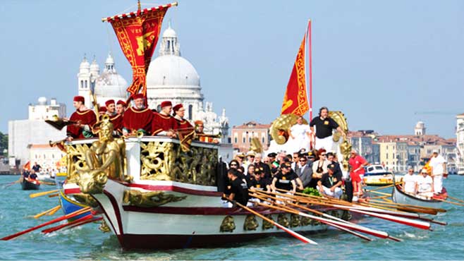
Every year at Ascension Day (Ascensione di Cristo, or “Festa della Sensa” as the Venetians say, it is celebrated in May) the Republic of Venice celebrates itself but also it’s intimate relationship to the sea.

In the age of Renaissance the head of state, called the Doge, would be rowed out to the island Sant Elena in a boat. Upon entering the open sea, he would throw a golden ring in to the water as a sign of matrimony to the Mediterranean Sea.

This tradition stopped when the independent republic dissolved in the so called Fall of the Republic in 1797. Since the 1960’s Venice has picked up the tradition and the ritual is enacted anualy by the mayor of Venice.

The tradition is believed to be more then 1.000 years old and probably has origins in even older pagan rituals. There are various related stories and rituals of sacrificial offerings to the sea, often with the intent of making it more lenient for sea travels.

Painting by Canaletto (Giovanni Antonio Canal) from 1745

See the respective Wikipedia article here.

Mazu: Taoist Goddess of the Sea

The bronze statue in the center depicts Mazu or Matsu, the chinese sea goddess, who is particularly popular in Taiwan and Chinese communities outside of mainland China. This monument is at Chengshan Peak (成山头 Chéngshāntóu), in the harbur city Weihai on the Chinese east coast. According to wikipedia: “Today, Mazuism is practiced in about 1.500 temples in 26 countries around the world, mostly in the Sinosphere or the overseas Chinese communities such as that of the predominantly Hokkien Philippines.” The first mentions of Mazu are from the 10. Century AD.

Vineta: the first mention

Vineta is a mythical sunken city off the German or Polish North Sea Coast. I was suprised to find out that the first mention of Vineta can be found in the travel writings of Ibrahim ibn Yaqub from around 960 CE. According to historians, Ibn Yaqub was a traveler and merchant from a jewish-seraphim family from Spain, who converted to Islam and who traveled extensively through Northern Europe. He wrote in arab and gave the first reliabel accounts of the Polish and Viking societies. He mentions a city called “Weltaba” – in modern Polish “Wełtawa” translates roughly as “place among waves” – and which he describes as the largest city in Europe, close to the sea and with twelve gates, located in the farthest north-west corner of what is today Poland.

There are other accounts about such a northern metropolis from the 10. and 11. Century CE: “The very respected town of Vineta once lay at the mouth of the Oder to the Baltic Sea,” writes Helmold von Bosau (1120 – 1177) in his “Slavic Chronicle”, “which offered the Slavs, Greeks and Saxons living around it a world-famous base. Of all the cities in Europe, it was certainly the largest and inhabited by many peoples. In terms of manners and hospitality you could not find more decent and kind-hearted people than there. Rich in goods from all countries, that city had all amenities.”

But mentions cease after around 1.170 CE. Today it is assumed that Vineta, or Weltaba, is not one city but rather that the myth actually combines the historic events around two cities and political centers of that era: Jaromarsburg (Arkona) and Wolin or Vimne. Both cities were either destroyed or deserted at the beginning of the 11. Century CE and both were powerful and wealthy cities. It took another 600 years for Vineta to reappear on several maps, but this time as a myth or a historical speculation.

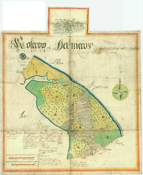
Drawing from a swedish map from 1693.

For more information see also here and here (both German)
and the other posts in this blog.