“When you could walk from London to Paris to get a Croissant for breakfast…” (Jeff Goodell)
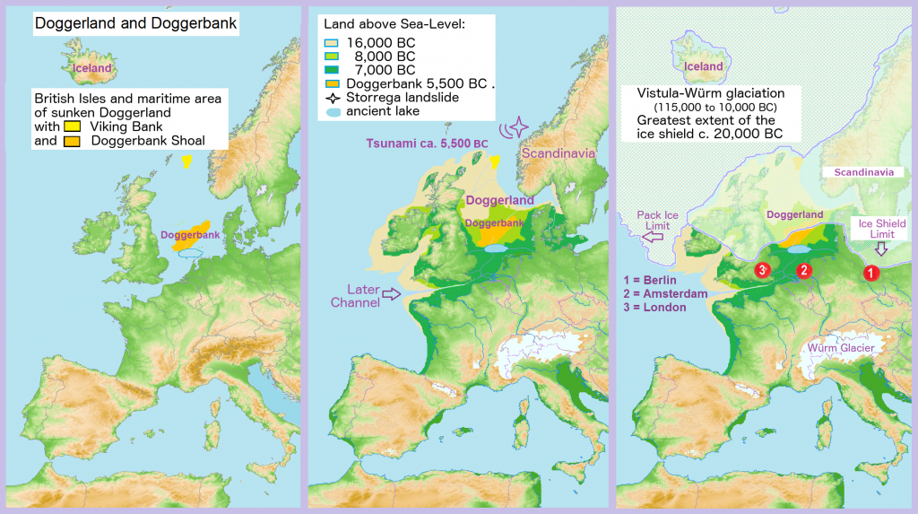
Land bridge between the mainland and Britain – Doggerland and Dogger Bank. Comparison of the geographical situation in 2000 to the late years of the Vistula-Würm Glaciation. Translation from German into English of File:Doggerland3er.png using GIMP (XCF file available for use in further translations).
As ice melted at the end of the last glacial period of the current ice age, sea levels rose and the land began to tilt as the huge weight of ice lessened. Doggerland eventually became submerged, cutting off what was previously the British peninsula from the European mainland by around 6500 BCE. The Dogger Bank, an upland area of Doggerland, remained an island until at least 5000 BCE. A recent hypothesis suggests that around 6200 BCE much of the remaining coastal land was flooded by a tsunami caused by a submarine landslide off the coast of Norway known as the Storegga Slide. (source Wikipedia)
There is a beautifully written passage on the submerged continent and city Atlantis to be found in Jules Verne’s famous novel published in French in 1869/1870. The English translation of the chapter is available online. For simplicity reasons I simply copy the link to the chapter here.
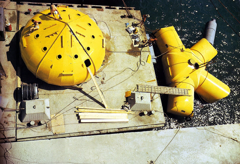
Continental Shelf Station was an attempt at creating an environment in which people could live and work on the sea floor. Precontinent has been used to describe the set of projects to build an underwater “village” carried out by Jacques-Yves Cousteau and his team in the Mediterranean and the Red Sea between 1961 and 1963. The projects were named Precontinent I, Precontinent II and Precontinent III. Particularly Precontinent II off the Sudanese coast received wide public recognition and was documented in a movie with the somewhat sensationalist yet eerie title “World without sun“. For a good overview of the project see: https://www.closed-worlds.com/conshelf-ii-iii or https://www.messynessychic.com/2013/05/27/remains-of-an-underwater-habitat-left-by-1960s-sea-dwellers
In 1783 an unsual seismic event sequence occured along the Strait of Messina between the island Sicily and mainland Italy. Katrin Kleemann from LMU Munich writes: “Between 5. February and 28. March 1783, five strong earthquakes shook Calabria and Sicily and were followed by hundreds of aftershocks in the following years. The earthquakes caused ten tsunamis.”
That same year additional earthquakes were reported from western France and Geneva on July 6., in Maastricht and Aachen on August 8., and in northern France on December 9. This was not too long after the disastrous earthquake and tsunami that hit Lisbon in 1755.
All these events were widely communicated and written about all across Europe. It was the age of enlightment and the disasters challenged religious, philosophical and political views of the time but also sparked artistic creativity.
Societies were in high demand for images of the disasters and artists, who naturally could not work from first hand observation and experience, were forced to invent formal solutions for this problem.
One strategy was to combine different temporal levels in one painting: the moment before the event, the aftermath, and sometimes even events that had no logical connection other than in the public mind.
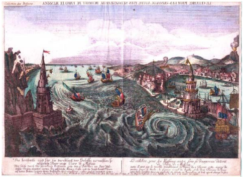
Katrin Kleemann writes about this image: “This hand-colored copper engraving portrays the Strait of Messina from the north at the moment the earthquake struck. To the left it depicts the coast of Calabria, to the right the harbor of Messina, and to the far right an erupting Mount Etna, although it did not actually erupt in 1783”, but in 1780 and then again in 1787.
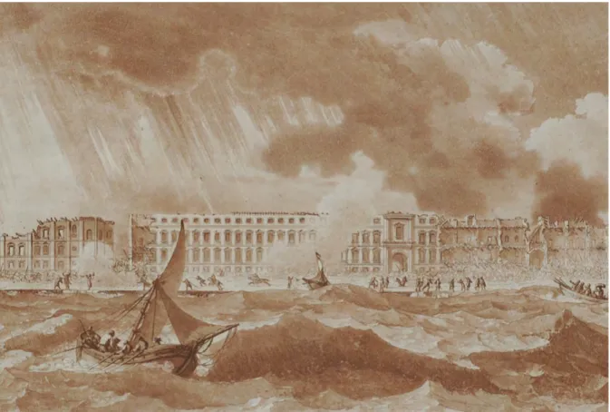
Another striking example is the painting »Vue de la Palazzata de Messine au moment du tremblement de terre« by French artist Jean Houel.
Hans-Rudolf Meier writes: “Jean Houel published in his »Voyage pittoresque« one year after the earthquake in the Sicilian port. Houel, who had traveled in Sicily before the earthquake and had not himself seen the extent of the destruction—to say nothing of the event itself—successfully recorded before and after in one picture by depicting the palace in the margins as a ruin, but showing it still intact in the middle of the picture. Here the special quality of buildings for impressive representations of the effect of a disaster becomes evident: on a building the sudden transformation from a consummate cultural achievement to a ruin can be perceived as a symbol of transience. In Houel’s engraving the observer, similar to today’s television viewer, witnesses the moment of destruction from a secure distance. The churning sea in the foreground cannot bridge this distance either, but it is intended to suggest something of the danger—and thus the authenticity—to which the fictive recorder of the scene might have been exposing himself.
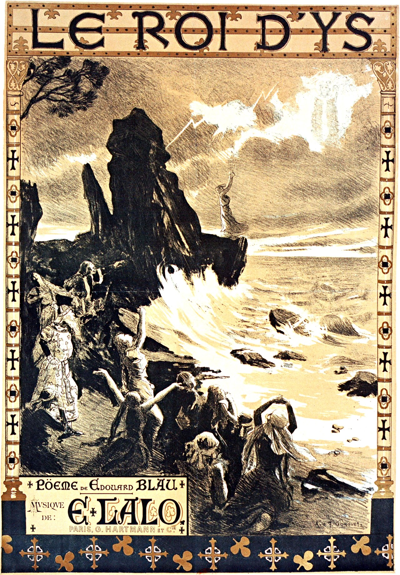
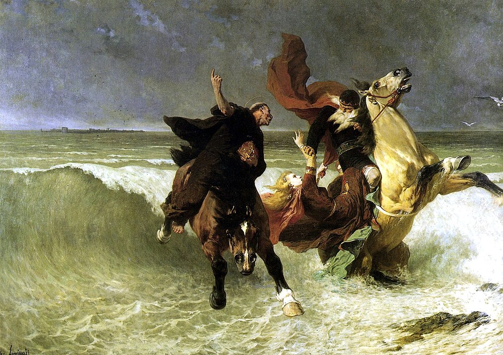
“Le roi d’Ys” is an opera by French composer Édouard Lalo (1823 – 1892), to a libretto by Édouard Blau, based on the old Breton legend of the drowned city of Ys (assumed geographical location).
Prelude for solo piano written by the French composer Claude Debussy, published in 1910. To quote wikipedia: “This piece is based on an ancient Breton myth in which a cathedral, submerged underwater off the coast of the Island of Ys, rises up from the sea on clear mornings when the water is transparent. Sounds can be heard of priests chanting, bells chiming, and the organ playing, from across the sea. Accordingly, Debussy uses certain harmonies to allude to the plot of the legend, in the style of musical symbolism.”
The assumed location of Ys can be found in my map.
Stained glass window from 1917 representing “Saint Guénolé, abbé de Landévennec, sauvant le roi Gradlon lors de la submersion de la ville d’Ys” in the Church of Saint-Germain in Kerlaz.
Information about the legend of the sunken kingdom Ys and it’s assumed location.