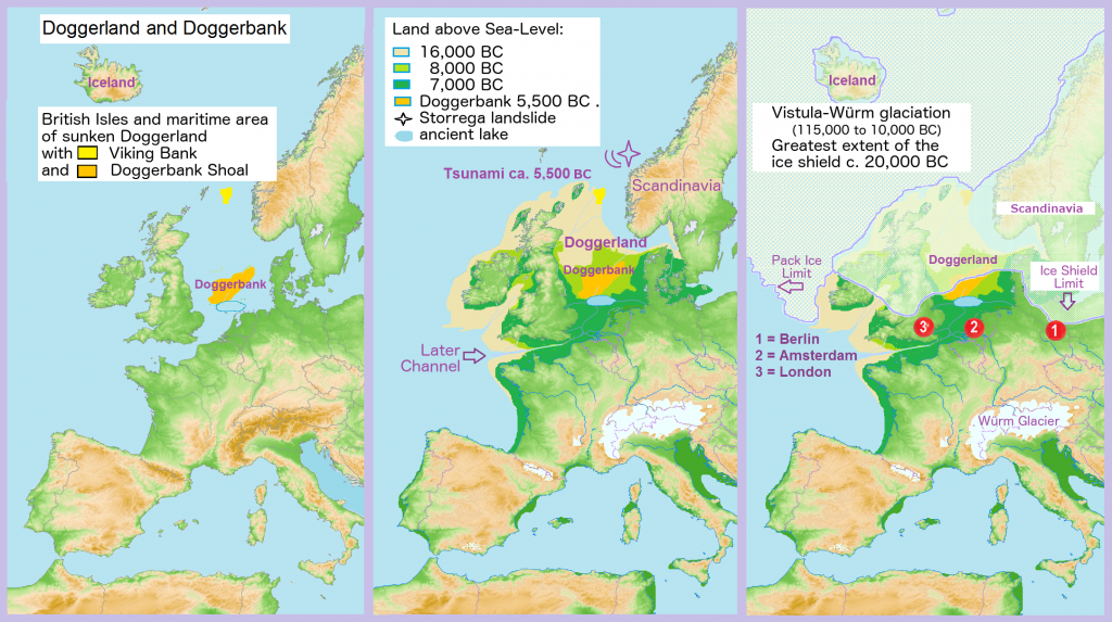
“When you could walk from London to Paris to get a Croissant for breakfast…” (Jeff Goodell)

As ice melted at the end of the last glacial period of the current ice age, sea levels rose and the land began to tilt as the huge weight of ice lessened. Doggerland eventually became submerged, cutting off what was previously the British peninsula from the European mainland by around 6500 BCE. The Dogger Bank, an upland area of Doggerland, remained an island until at least 5000 BCE.
A recent hypothesis suggests that around 6200 BCE much of the remaining coastal land was flooded by a tsunami caused by a submarine landslide off the coast of Norway known as the Storegga Slide. (source Wikipedia)