Vesuvius – the most beautiful disaster

The erupting mount Vesuvius in Italy is one of the most popular motives in modern art history, particularly throughout the 18. and 19. Century – at least as far as disasters go. Between 1766 and 1779 the volcano erupted several times, giving artists occasions to witness the event personally. The topic and it’s visual representation have played a major role in Europe’s public imagination of natural disasters.

Here are a couple of examples, mostly taken from the 2018 exhibition “Entfesselte Natur” (Nature Unleashed) at Kunsthalle Hamburg, Germany.

above: Pierre-Henri de Valenciennes (1750–1819): “Eruption of Vesuvius with the death of Plinius”, 1813

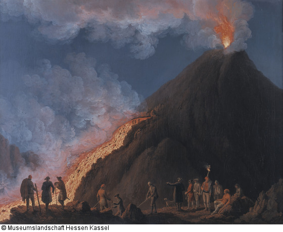
above: Michael Wutky (1739–1822): “Vesuvius Eruption”, around 1796

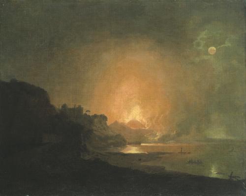
Joseph Wright of Derby (1734–1797): “Eruption of Vesuvius”, between 1776 and 1780.

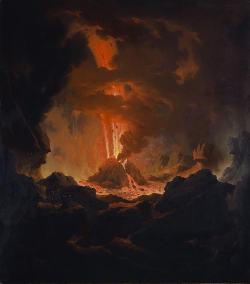
Pierre Jacques Volaire: “The Eruption of Vesuvius”, 1771

Jakob Philipp Hackert (1737 – 1807): “Vesuvius Eruption in the year 1774”, 1774

For more information and the philosophical ideas behind the eruption of mount Vesuvius in art history see my post here.

Are floating cities a remedy for over-crowded coastal cities, land subsidence and rising sea level?


As this documentary from German TV from 2022 clearly shows, designing floating cities is one thing, wanting to live there is quite another. I guess instinctively we all prefer “stability over floating flexibility”, as director Kristin Siebert says, land over sea, grounded houses over floating houses. As desirable living by the sea might be, living on it, is a different matter.


The film does a fine job connecting and juxtaposing places and communities from the global south and global north, sharing similar fate and trying out similar solutions.


If floating cities are a real future option for communities challenged by climate change like Malé, the capital of the Maledives, we need to look at the socio-cultural and emotional aspects of what makes people feel at home. And that might be essentially the same in the Pacific as in Germany or Holland. Breaking with a culture of habitation of several thousand years is no easy task!

(thanks to Janina Kriszeo for the lead!)

Click on image for video link!

Storm surge Xaver in Hamburg

On December 6, 2013, hurricane “Xaver” led to the second highest storm surge ever measured in Hamburg. The water level of the Elbe rises to 6.09 meters above sea level, roads near the river are under water. But people are spared: the dikes hold up.

© dpa, Foto: Christian Clarisius
© AFP / Bodo Jel
© AFP / patrick Lux
© Christian Clarisius (dpa)

Maritime murals in German cities

Mural in Bremen Neustadt advertising the local beer company Beck’s. The building and the brewery are directly adjacent to a dike that is in urgent need of renovation and elevation.

A building at Hongkongstraße in Hamburg’s harbour district adorned with japanese style waves.

Not a mural but a floor design at the new harbour in Bremerhaven. Large white fish are painted across the cement floor of a public space called Wily-Brandt-Platz, that has been redesigned in 2013.

Old Maps of Future Floodings

There are many projects for the visualisation of the effects of rising sea levels. The US-American company Climate Central presents dozens of photo-realistic images of potentially flooded areas. Like the flooded Super Bowl Stadium in Florida:

They even offer animated gifs and other before-after-imagery. In this example a section of Hamburg in Germany now (left side) and 50 years from now (right).

A different approach is the speculative cartography by designer Jeffrey Linn. His “retrofuture” maps appear like antiques but depict future scenarios. In this case, a partially flooded San Francisco Bay. His work is for sale here

USA; 21. Century; Christian; Photography, Maps, Illustration; Cities: San Franscisco, Hamburg