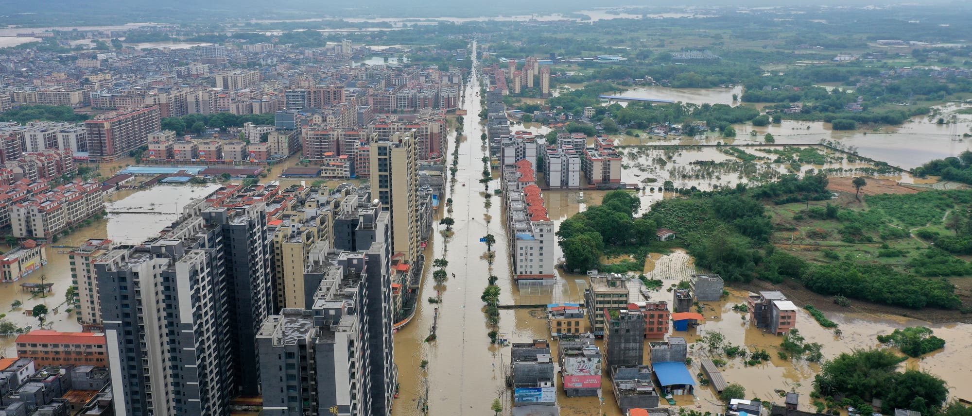
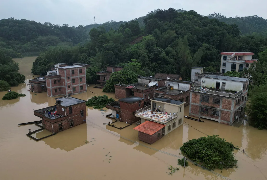
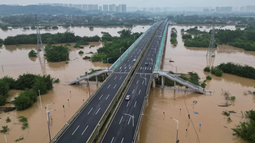
These images are from news reports from the metropolis in the Guangdong province, Southern China. The region experienced massive floodings in April 2024 once more due to intense rain. It’s not a coastal city, instead Qingyuan has been repeatedly flooded by water from the Bei Jiang river.
The 1970 Bhola cyclone (also known as the Great Cyclone of 1970) was a devastating tropical cyclone that struck East Pakistan (present-day Bangladesh) and India’s West Bengal on November 12, 1970. It remains the deadliest tropical cyclone ever recorded and one of the world’s deadliest humanitarian disasters. At least 300,000 people died in the storm, possibly as many as 500,000, primarily as a result of the storm surge that flooded much of the low-lying islands of the Ganges Delta. Bhola was the sixth and strongest cyclonic storm of the 1970 North Indian Ocean cyclone season.
Yajnaseni Chakraborty writes in an online article, that the cyclone also formed a new nation: Bangladesh. Since the 1940’s East-Bengal had been a part of Pakistan, officially called East-Pakistan, and was governed by the central Pakistani military government: “A few days after the disaster, with East Pakistanis seething in anger against the West Pakistan government, political leader Maulana Abdul Hamid Khan Bhashani held a rally at Dhaka’s old Paltan Maidan, famously declaring, “Ora keu aseni (none of them turned up),” and went on to say, “From today, we are independent East Bengal, no longer East Pakistan”. The next day, says Haider, ‘Ora keu aseni’ was printed as a banner headline in the newspaper ‘Pakistani Khabar’, controlled by the Pakistan government’s Press Trust.”
The following Bengal War in 1971 took another 3 million Bengali lives, according to the Bangladesh government. In August 1971 the nation was finally declared independent. Today Bangladesh is regarded as one of those countries with a highly effective disaster protection program.
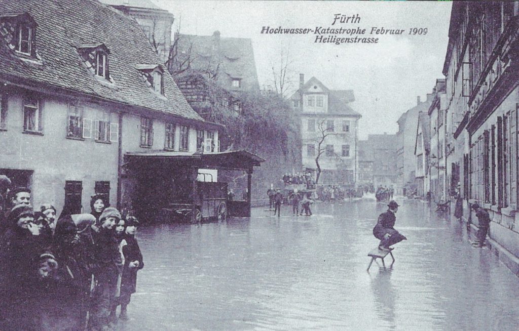
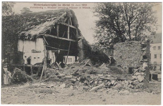
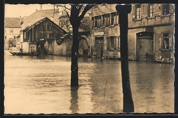
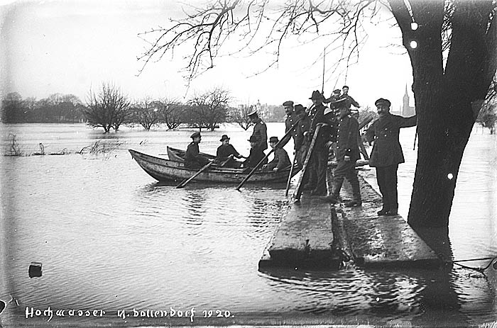
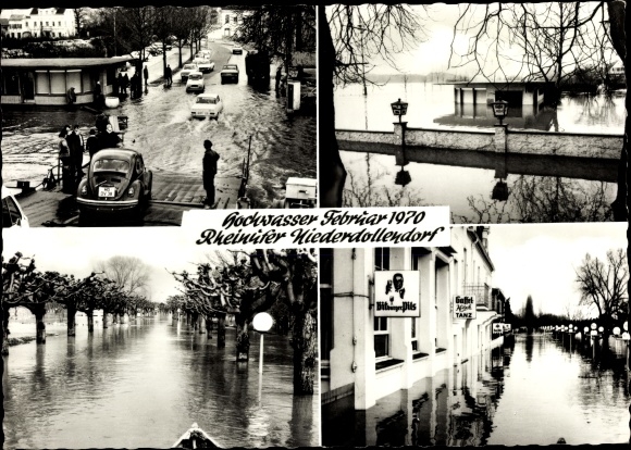
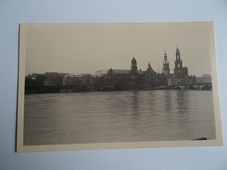
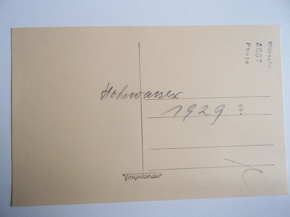
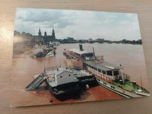
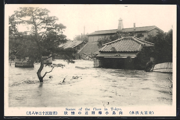
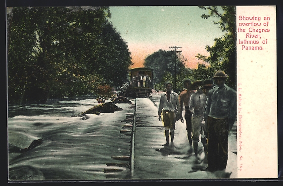
In Germany as well as in many other countries, images of extreme floods often found their way on postcards. Here is a selection of postcards. (click on the image to find the online source)
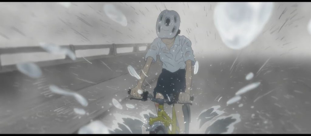
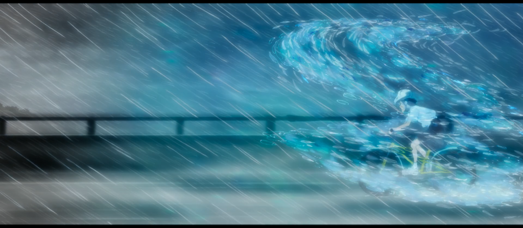
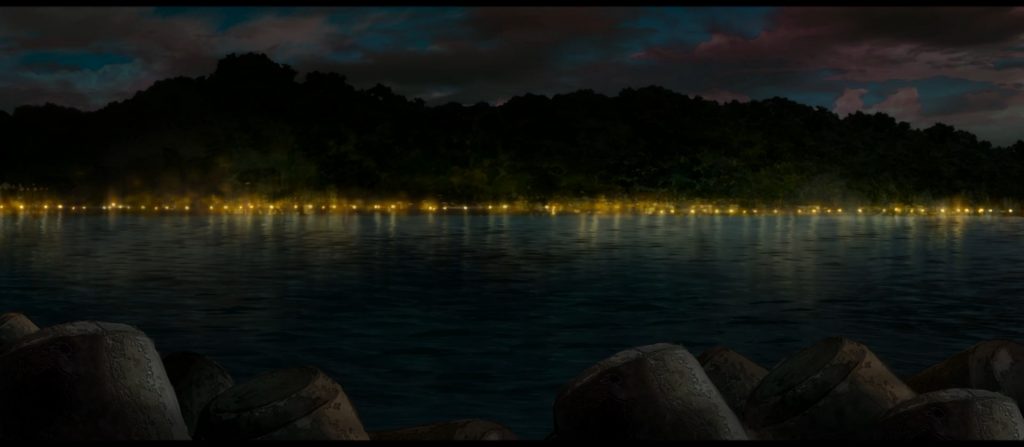
2019 Japanese anime movie “Children of the Sea” (original title: 海獣の子供, which translates roughly as “Children of Sea Monsters”) is set in a fictitious island in the Okinawa region of Japan. The movie directed by Ayumu Watanabe puts a lot of effort into creating the image of a culture and a way of life, that is aquatic or located in a fluid continuum between dry land and water, the city and the sea. Here are screen shots from two scenes of intense tropical rainstorm that blur the distinction between land and sea.
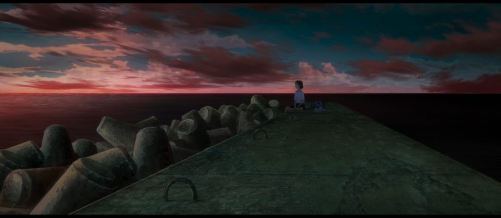
Another noteworthy scene is the following, set on a pier that is aligned with concrete tetrapopds. These tetrapods have been used since the 1950s all over the world to protect coasts against erosion and flooding. They are particularly prominent across Okinawa and have come to define the look of the coasts there. (See the wiki article here)
Since the movie’s plot is about the meeting and friendship between two brothers born in the sea and a city girl and the girl’s eventual emergence into the underwater world, the tripods here seem to symbolize the community’s effort to maintain the separation between land and sea and protect it’s people from the forces bur also the allure of the ocean.
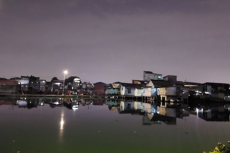
This romantic image is actually a disaster area: Kampung Apung Teko, one of Jakarta’s many villages, has become more and more flooded until it gained a new reputation as Jakarta’s only floating village. A more than questionable feat. Until the 1990s, the three-hectare village was a community adjacent to rice fields. Now it is accessible only through foot bridges. The population was down to 200 households around 2010.
But Apung Teko will lose it’s title sooner or later as a quarter of the city could be underwater in less than a decade. Further reading: Link and Link
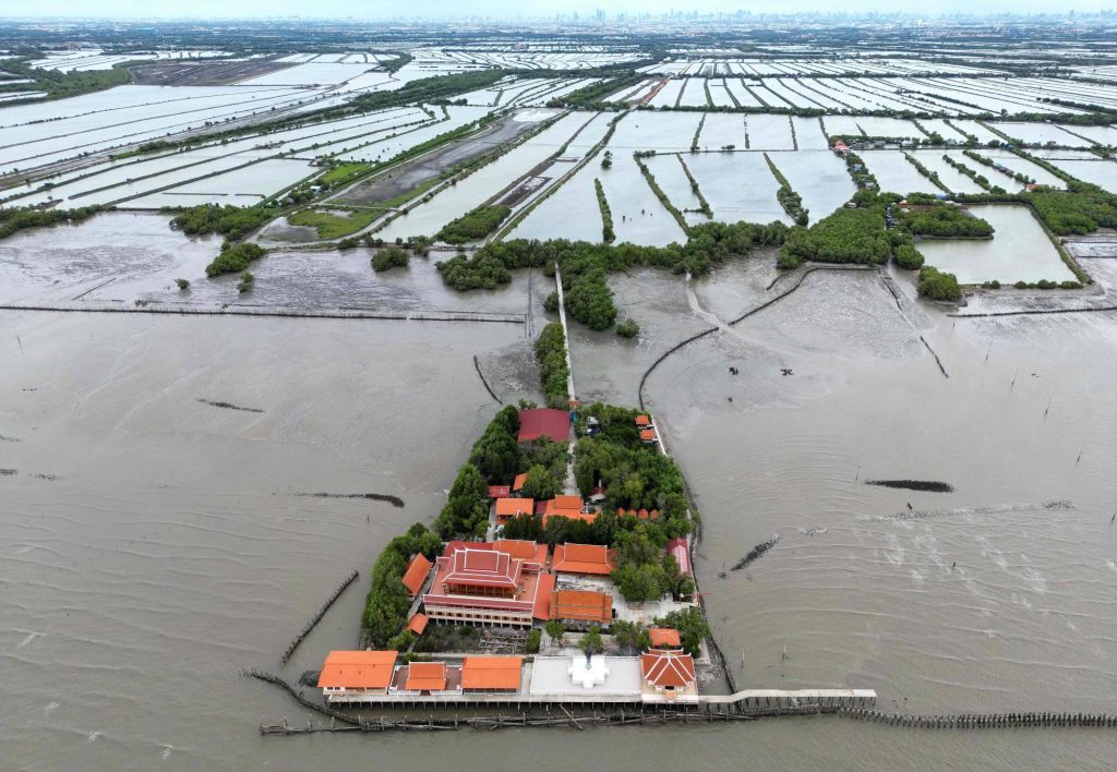
This aerial photograph taken on June 14, 2023 shows the Buddhist temple called Samut Trawat of Ban Khun Samut Chin, a coastal village 10 km south of Bangkok, as seen in the background. At Samut Chin, the ocean has approached by 2 kilometers in the past 60 years. While all other buildings were abandoned and the population settled about a kilometer further inland, the monks lifted the building by two meters and it is now only reachable by way of a small wooden footbridge. The religious site and the monks caring for it and protecting it against the rising sea level has become emblematic of the situation in the Bangkok Bay. Here’s another foto from 2015 that shows the inside of the temple. You can clearly see how the floor of the room was raised and the water marks on the cement walls.
I have already posted several other images of inundated religious sites across Asia here and here. The most famous one maybe being the Wal Adhuna mosque just outside the sea wall in North-Jakarta. Temples and Mosques have a special value as safe spaces and centers of communities, it is thus no surprise that they become focus points of imagining and expressing our ecological fears.
Here are two articles from 2015 and 2023 about the fate of Ban Khun Samut Chin with more background information.
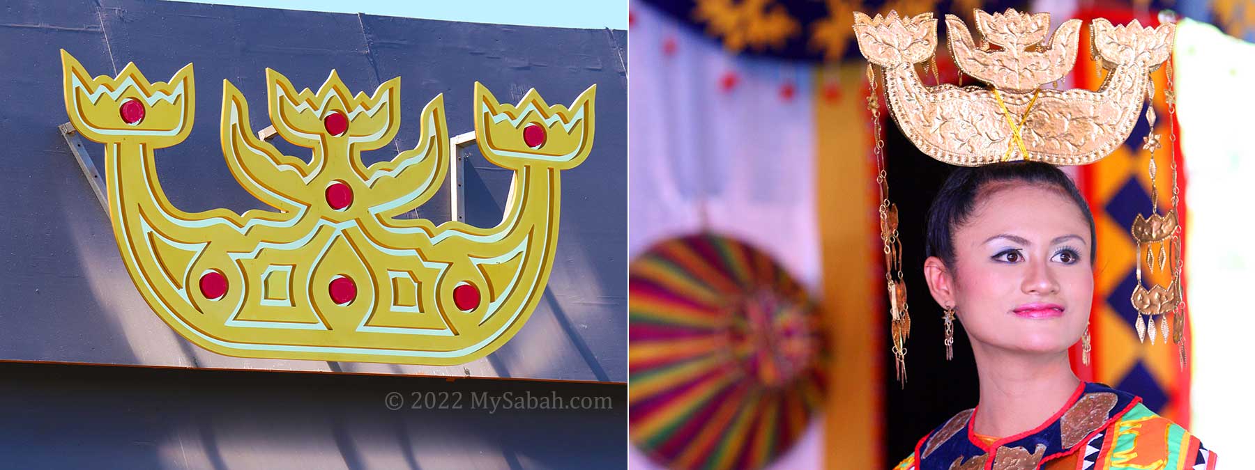
This is the traditional festive head gear worn by Bajau women. The Bajau, a formerly nomadic people now mostly home to Malaysia, Indonesia and the Philippines, live by and from the sea and have recently gained recognition for a genetic trait that allows them to dive deeper and for longer time stretches than any other ethnic group. They are often referred to as Sea People and this traditional head gear seems to symbolize this. I could not find any interpretation of the shape, but they appear to me like ships or tail fins of sea mammals or mermaids – or all three.
The Orang Laut, who mainly settle in Singapore, Malaysia and Indonesia, the Moken in Thailand, and the Sama-Bajau who mainly live in East-Malaysia and the Philippines are ethnic groups that have a seaborne or amphibian lifestyle and culture.
The Malayan name Orang Laut literally translates as Sea People. The Moken are also called chao nam in Thai, meaning “people of the water”. Both the Moken and the Bajau are nomadic societies, moving between islands along various coasts, some families even spending long periods of the year living on their boats. The largest group, the Bajau, are said to exist for over 1.000 years. I did not know that there were nomadic sea faring societies like that at all. Apparently several Bajau myths exist that explain how and why they first adopted their nomadic lifestyle.
This picture of a “typical” settlement of Bajau in the Philippines I find particularly striking for the isolation of the individual buildings and the lack of any visible land close by:
Traditionally these societies lived from fishing but there are anthropological indications that at least the Bajau were once an agricultural society. Their traditional lifestyles center around fishing and harvesting sea plants and the often nomadic lifestyle make them very vulnerable to environmental damage, economic and political exploitation and oppression. Many of them have meanwhile settled on land and further off the sea coast for better employment opportunities.
This image of a Bajau boat fair, called Regatta Lepa, shows a striking similarity to the festival of Marriage to the Sea that is celebrated in far away Venice, Italy. (see my blog entry)
Two other links are noteworthy here: In the Boxing Day Tsunami of 2004, the Moken people who lived around the Surin Islands of Thailand were able to predict the events quite accurately which allowed them to warn and protect the island population. However in other places, Moken suffered severe devastation to housing and fishing boats by the tsunami. (see related scientific report on indigenous knowledge and disaster here.)
These ethnic groups are probably the inspiration to many myths about sea people in the region. As biological studies have recently revealed, the Moken and Bajau show genetic traits that allow better under water vision and a significantly greater ability to dive and hold their breath. These sea people are probably the closest humanity gets to mythical figures like “aqua men”, “frog men” or “mermaids”. (See for example the Filippino movie “Beyond Atlantis” from 1973.)
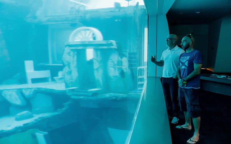
“Take the plunge and explore an abandoned and flooded city, an incredible 60 meters underwater. Experience Deep Dive Dubai – a world of exciting and unique scuba and freediving opportunities,” reads the website of Deep Dive Dubai, a newly opened diving resort. The resort is said to be conveniently located “– 15 minutes from Downtown Dubai and 25 minutes from Dubai International Airport –” and sets the world record for the deepest artificial diving pool, featuring artificial ruins for the divers to explore.
Of course, Deep Dive Dubai, cashes in on the uncanny of a dive among ruins in a city that according to studies from 2010 could very likely be submerged by 2100. Dubai ranks high among the coastal cities most at risk from sea level rise. The “sunken city” appears to be such a vital marketing element, it even has it’s own icon on all webpages of the company, as you can see below:
Artificial ruins are not a new idea. They were already once the rage among landscape architects in the period of romanticism in the 19. century all over Europe. For more info on the cult of ruins, you can read online the publication by Anne Eriksen enticingly titled “The Murmur of Ruins” or check out the wikipedia entry on ruins with images of the garden of the castle Schönbrunn in Vienna.
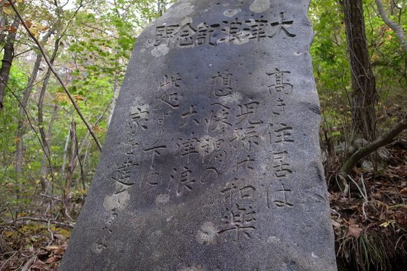
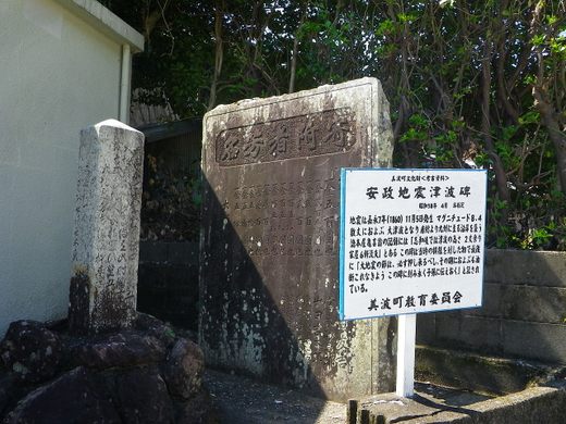
“Hundreds of tsunami stones stand along the coast of Japan, stark warnings and reminders of the devastating impact of the country’s all too frequent tidal waves. The oldest were erected more than 600 years ago; some have been washed away by ever more powerful waves.”
This is a quote and image from an online article about this cultural heritage that came to prominence as a shocking example of the negligence of cultural heritage in our age. Of course these stones can be found as well in Kesennuma, the province that was hit hardest by the 2011 Tsunami, which also caused the Fukushima Nuclear Accident. I unfortunately do not remember, in which text I first found the reference.
The article goes on with the following list:
“Japan has borne the brunt of some of the worst tsunamis in history. In 1707, a tsunami caused by the Hōei earthquake killed more than 5,000 people. The Great Yaeyama Tsunami of 1771 killed 8,439 people on Ishigaki Island and 2,548 more on Miyako. In 1896, the Sanriku earthquake sent two tsunamis crashing into coastal settlements, destroying some 9,000 homes and killing at least 22,000. More recently, the Tōhoku earthquake and tsunami of 2011 left 15,894 dead, 6,156 injured, and 2,546 missing.”
But there are also apparently cases, where people were smart enough to do follow the advice enscribed on the century old stones:
“One particularly well-documented tsunami stone stands in the village of Aneyoshi on Japan’s northeastern coast. Aneyoshi had endured two devastating tsunamis, one in 1896 and another in 1933. The stone was placed shortly after the 1933 tsunami, a four-foot-high marker located just above the tsunami’s highest reach. It reads: “High dwellings are the peace and harmony of our descendants. Remember the calamity of the great tsunamis. Do not build any homes below this point.”
When the stone was placed, the remaining residents of Aneyoshi—there were only four—moved uphill for good. Heeding the advice of the tsunami stone, they moved above the reach of the last tsunami, which undoubtedly saved them from being devastated once again in the tsunamis of 1960 and 2011.”