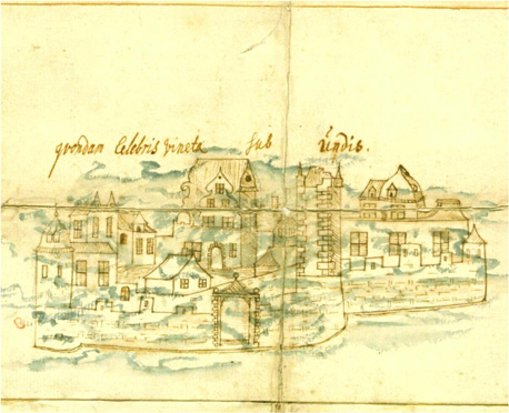
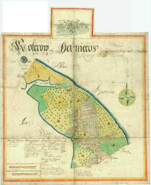
A map of the Swedish state survey of Pomerania, the first comprehensive cadastre of a German territory, shows how much the sunken city in the sea fascinated the contemporaries. Towards the end of the 17th century, Swedish land surveyors had mapped and described Western Pomerania, which had fallen to Sweden in the Peace of Westphalia. This resulted in more than 1700 colored maps. Only in one case did the cartographers add a decorative depiction to the map image. It is the map of Koserow and Damerow on the island of Usedom. A city view with baroque gabled houses, city wall, gate and castle has been added above the map image and painted over with a transparent blue. From the Latin description we can gather that this is the famous sunken city of Vineta. So the Swedes suspected Vineta before Damerow.
Source (german): https://www.kulturwerte-mv.de/Landesarchiv/Archivalien/Bisherige-Beitr%C3%A4ge/2009-09-Vineta-auf-einer-Karte-schwedischer-Landmesser/
Germany; 17. Century; Christian; Illustration on Map; City: Vineta